ShakeOut Earthquake Drill, Thurs. Oct 20, 2022

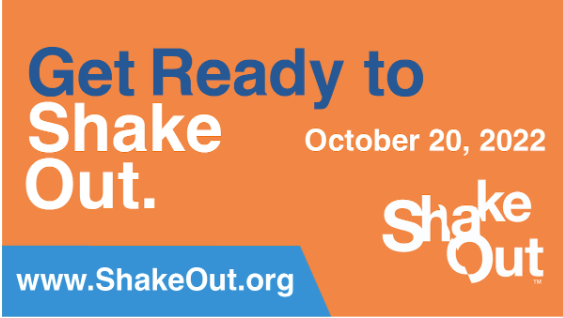
Thursday, October 20th, 2022 is the day for ShakeOut, the largest earthquake drill. The information below comes from Shakeout.org.

It’s almost time for this year’s International #ShakeOut Day, on Thursday, October 20, though as always you can hold your drill on any other day.  Already 16 million people across the U.S. are registered to participate in 2022, as part of more than 40 million people total worldwide! 

Do you have everything you need for a successful ShakeOut drill? Check out the tools and tips below, including for how to motivate others to participate!

Register for the 2022 ShakeOut

Looking to take part in some fun events leading up to ShakeOut day? The Washington ShakeOut team has you covered! 

At 11 a.m., Oct. 19, the Washington Emergency Management Division will team with scientists and other preparedness experts for an Ask Me Anything event on Reddit.

At 10 a.m. on Oct. 20, the Washington Emergency Management Division will field your earthquake-related questions on their Facebook page as they prep for ShakeOut Day in the state Emergency Operations Center. You can also email questions to public.education@mil.wa.gov.

At 10:20 a.m. on Oct. 20, a test alert of the ShakeAlert earthquake warning system will be sent to mobile devices with the MyShake App installed.  See #4 below for more details! 

At 10:20 a.m. on Oct. 20, all Tsunami Sirens will also go off at 10:20 a.m., so you know what they will sound like in an actual emergency. The ShakeOut is also a perfect  time to practice your tsunami evacuation routes after you Drop, Cover, and Hold On!”

The above video is one of several public service announcements (in multiple languages and lengths), which can be viewed on Youtube or downloaded for your own use (including audio versions).

FLASH’s Buyer’s Guide to Resilient Homes has the information you need to identify homes that will still be standing after the disaster.

Retrofitting structures is one way we can ensure that our buildings and homes can withstand natural hazards. Download FEMA’s toolkit.

Top Tools for a Successful #ShakeOut
1. ShakeOut Drill Broadcast Recordings (audio and video), and Drill Leader Presentations

2. ShakeOut Drill Manuals and Other Drill Preparation Documents

3. ShakeOut Messaging, Graphics, and Videos for Promotion

4. NEW! Include Earthquake Early Warning as part of your organization’s ShakeOut this year1. ShakeOut Drill Broadcast Recordings (audio and video), and Drill Leader Presentations

1. ShakeOut Drill Broadcast Recordings (audio and video), and Drill Leader Presentations

Play a ShakeOut drill broadcast to help guide participants in their Drop, Cover, and Hold On drill, available on YouTube at YouTube.com/greatshakeout to stream or at ShakeOut.org/drill/broadcast to download ahead of time.

You can also use the ShakeOut Drill Leader Presentations for a more comprehensive approach to virtual and/or in-person drills, which include earthquake hazard information, ways to protect yourself in other situations, embedded drill broadcast recordings, and much more.

2. Drill Manuals and Other Planning Documents

Download drill manuals to help your organization plan the most successful ShakeOut! We have guides for a variety of sectors. You can also see ShakeOut.org/howtoparticipate and ShakeOut.org/resources for more information.

– Schools
– Higher Education
– Healthcare
– Businesses
– Non Profits and Other Organizations
– Government Agencies
– Options for Government Agency Participation and Outreach
– Many other sectors

“ShakeOut Activity Pages” from Rocket Rules can help younger students learn about ShakeOut: 
RocketRules.org/earthquake-activity-books-videos.

3. ShakeOut Messaging, Graphics, and Videos for Promotion

Promote ShakeOut to your participants and those around you with all the messaging templates, graphics, and videos available at ShakeOut.org/messaging! This includes resources for social media, news media templates, videos and graphics, guidance in multiple languages, and more, such as in the examples below:Sample tweet and optimized Twitter graphic (Join Us):

“#ShakeOut, the world’s largest earthquake drill, is 10/20! 
Join us: ShakeOut.org/register.
Animated GIFs such as these are great for promoting ShakeOut across social media! See ShakeOut.org/messaging to download them, or access them in the Giphy library on Twitter or Instagram (search on #ShakeOut).

Discover the Earthquake Safety Video Series, downloadable from ShakeOut.org/messaging and streaming on YouTube at YouTube.com/greatshakeout

.

4. NEW! Include Earthquake Early Warning as part of your organization’s ShakeOut this year

Add a new element to your ShakeOut drill this year by including the planned test of the USGS ShakeAlert®-powered earthquake early warning system in California, Oregon, and Washington, to be distributed through the MyShake App! To receive the test alert at 10:20am on 10/20, be sure to have downloaded MyShake from the Apple or Google app store, and set it up on your mobile device.Then check out a excellent new guide from the USGS and many partners for how to include earthquake early warning within tests, drills, and exercises, including of course ShakeOut!

ABC: 7.7 Earthquake Strikes Between Jamaica and Cuba, Jan. 28, 2020

A tsunami warning has been issued. A building in downtown Miami was evacuated because of the shaking.

From ABC News

A magnitude 7.7 earthquake occurred north of Jamaica on Tuesday afternoon. The epicenter was located in the Caribbean Sea about 83 miles north of Montego Bay, the capital of St. James, according to USGS.

It was a relatively strong but shallow quake with a depth of about 6 miles. A 7.7 magnitude earthquake is at the high end of the Richter Scale.

It was initially reported at 7.3 but was quickly revised up to 7.7.

There were no immediate reports of injuries or damages.

From KAKE ABC:

The quake also hit the Cayman Islands, leaving cracked roads and what appeared to be sewage spilling from cracked mains. There were no immediate reports of deaths, injuries or more severe damage, said Kevin Morales, editor-in-chief of the Cayman Compass newspaper.

The islands see so few earthquakes that newsroom staff were puzzled when it hit, he said.

″‘It was just like a big dump truck was rolling past,”’ Morales said. “Then it continued and got more intense.”


Citylab: How Portland’s Earthquake Preppers Are Planning for the Worst

While the decision to survive is a personal one, your ability to survive is exponentially enhanced by having a community which has decided to survive. In this article from Citylab, one neighborhood in Portland discusses how and why they formed and what they are doing to be prepared. Have you met your neighbors and mapped your neighborhood? Meet people, build trust, and grow community. It will help you survive – not just in disasters.

…“One of the main elements of disaster preparedness is knowing your neighbors,” Michael Hall says as the meeting begins. He’s the bell-ringer and leader of Alameda’s self-titled “Council of Blockheads,” which represents a two-block, 25-household area. For the last four years, the residents of this leafy neighborhood have convened twice annually over a lofty goal: ensuring the survival of everyone on the block in case of a disaster.

For the next 30 minutes, the group talks about whether to order more stackable emergency water containers and how much extra food to stock up on (the new advice: enough for two weeks). They listen to earthquake survival tips from a guest speaker, Marilyn Bishop, who sells pre-made emergency prep kits full of freeze-dried rations. Four years ago, these neighbors hardly knew each other. But after seven meetings and counting, they now see each other as their lifelines.
Hall is one of the many residents of the Pacific Northwest reckoning with the terrifying potential of the Cascadia Subduction Zone earthquake that many experts believe will strike in the next 50 years. The overdue super-quake could trigger devastating coastal tsunamis—waves up to 85 feet high—and deliver potentially massive damage to homes, highways, and water and power infrastructure. Galvanized by Kathryn Schulz’s 2015 New Yorker story “The Really Big One,” Hall was eager to do something. So he gathered a few neighbors at his house over beers to brainstorm. The result was their first disaster-awareness block party, where nearly every household had a representative. The block parties became the way to make catastrophe preparation less overwhelming.

They started holding twice-yearly informational meetups with guest speakers and workshops that covered how to create a family emergency plan, human waste storage systems, and water and food storage. They made a bulk order of water bricks. And they created and continue to update a comprehensive inventory of neighborhood contact information, emergency supplies (such as generators, tools, and camping equipment), and skills (e.g., first-aid, carpentry, childcare). Some neighbors even gained additional training as Neighborhood Emergency Team (NET) volunteers—city-trained residents who deploy in a large-scale emergency…

Click here to read the entire article at Citylab.

ARRL: ARES Standing By After Strong Earthquake Near Puerto Rico

From the ARRL:

A strong magnitude 6.4 earthquake hit Puerto Rico early on January 7 on the heels of a smaller magnitude 5.8 tremor a day earlier. The Puerto Rico Electric Power Authority reported widespread power outages after generating plants automatically activated protective shutdown systems following the earthquake. Puerto Rico Governor Wanda Vazquez Garced urged citizens to remain calm.

“The entire government is active and in action,” Governor Vazquez said in a tweet. “I ask our people to remain calm and urge you to remain safe.” Government offices have been shut down for the day.

The director of Puerto Rico’s Seismic Network, Víctor Huérfano, told The Associated Press that it’s been difficult to obtain reports of damage or injuries because communications are out over much of the island. Geologists had warned of additional seismic activity following the January 6 earthquake. Tremors have been occurring in some areas of Puerto Rico since December 28.

ARRL Puerto Rico Public Information Officer Angel Santana, WP3GW, said the earthquakes have damaged homes in communities including Guánica and Guayanilla, with aftershocks felt minutes later from today’s event. A tsunami advisory for Puerto Rico and the Virgin Islands was canceled minutes after being issued. Santana said the PREMA Emergency Operations Center (EOC) has been activated.

Santana said VHF and UHF repeater systems having emergency power carried reports of power outages and other information. ARRL Puerto Rico Section Manager Oscar Resto, KP4RF, told ARRL that no Amateur Radio Emergency Service (ARES) activations have been necessary, as commercial telecommunication systems remain functional.

“The situation is scary, with houses, schools, and roads collapsing,” Resto said, with many structures — including a school and homes in Guánica — damaged.

Related:

Washington Post: Puerto Rico earthquake Tuesday morning triggers blackout, reports of injuries and at least one dead

US Army: National Guard, Washington Guard Plan for CSZ Earthquake Response

From the US Army:

NGB, Washington Guard plan for earthquake response exercise

What do you do when 80% of your state’s population lives near the epicenter of a possible 9.0 earthquake? For members of the Washington National Guard, it means being ready to assist roughly 6 million people who live in such an area.

“We definitely need to plan and be prepared for what will come,” said Army Col. Kevin McMahan, director of operations, training and exercises with the Washington National Guard’s Joint Force Headquarters. “Not if, but when the ‘big one’ hits, it will affect populations from British Columbia [Canada] to Northern California.”

McMahan said many scientists predict such a catastrophic earthquake would trigger a tsunami with waves from 20 to 80 feet.

To prepare for such a scenario, Washington National Guard leaders and more than 40 National Guard Bureau subject matter experts met to help plan a disaster response training exercise.

“We never lose sight of the fact that the mission happens in the field, and for that reason we commend Washington [National Guard leaders] for their willingness to commit time and resources to come to D.C. and work with the NGB joint staff and the Air and Army readiness centers,” said Air Force Brig. Gen. Britt Hatley, vice director of plans at the NGB. “They came with many challenging questions and we appreciate the opportunity to provide any and all planning assistance moving forward.”

Scheduled for 2022, the Washington Cascadia Subduction Zone training exercise will focus on immediate response efforts and how Washington Guard members would integrate with local first responders. For Washington Guard leadership, the planning session goes beyond simply being ready for a training exercise.

“It’s not just about the exercise for us,” said Army Maj. Gen. Bret D. Daugherty, the adjutant general of the Washington National Guard. “We really want to be prepared for the day [an] actual earthquake hits. The better prepared and the more assistance we can get from Guard Bureau will only make us stronger, and it is really beneficial for the citizens of our state.”

In addition to teaming with NGB resources, Washington Guard leaders have been working with Washington state emergency managers to streamline communication and interoperability. Washington Guard leaders and emergency managers also worked together to prepare a resource guide for local residents to be “disaster ready.”

The goal is to be as ready as possible, said McMahan, adding that planning and building relationships makes response efforts run more smoothly.

NWNN: Research Shows Cascadia Quakes Sometimes Trigger San Andreas Fault

Here’s an article from the Northwest News Network about new scientific evidence that’s says that Cascade earthquakes have triggered San Andreas earthquakes several times over the millennia. How could disaster response be delayed and impaired if the entire west coast is impacted rather than just the north or south coast? Of course, the big question that remains to be answered is what magnitude of San Andreas quakes are triggered by Cascade earthquakes. The San Francisco metro area alone has around a million more people than the Seattle metro area. If a large CSZ quake triggered a large San Andreas fault quake, how far down the priority list would aid to outlying/coastal Washington towns fall if such a scenario were to occur?

New earthquake research to be presented by Oregon-based geologists
next week sounds like a B movie plot — a great earthquake along the
Pacific Northwest’s offshore Cascadia fault triggers another great
earthquake on the northern San Andreas Fault. In what may be a case
where life imitates art — or more precisely, where science catches up
to the fertile imaginations of Hollywood script writers — attendees at a
major earth science meeting in San Francisco will hear evidence that
this cascade of disaster happened many times over the past couple of
millennia.

“I mean, Cascadia is big enough by itself,” said lead
researcher Chris Goldfinger of Oregon State University. “But if you add
in San Francisco and the North Coast, it is literally almost a grade B
movie scenario that people don’t want to think about that much.”

…Goldfinger said he found nine to eleven instances over roughly the last
3,000 years where a Cascadia earthquake seems to have triggered a San
Andreas quake. The vast majority of great Cascadia quakes during that
period have a correlation on the San Andreas Fault. He added that his
analysis of landslide traces found no evidence for the stress transfer
working in reverse — from south to north…

Click here to read the entire story at NWNN.

Marginally related:

TMIN: Mt. Rainier And The New Madrid Fault Zone Were Both Just Hit By Significant Earthquakes

2019 Great Washington ShakeOut, Oct. 17th

Millions of people worldwide will practice how to Drop, Cover, and Hold On at 10:17 a.m. on October 17* during the annual Great ShakeOut Earthquake Drills!

Washingtonians can join them today by registering for the 2019 Great Washington ShakeOut. As of the first week of October, 1.24 million Washingtonians have registered to take part. Participating is a great way for your family or organization to be prepared to survive and recover quickly from big earthquakes– wherever you live, work, or travel. Learn tips on how to get 2 Weeks Ready and craft your own emergency kits here.

Start here to be included in the 2019 Washington ShakeOut!

Related:

Tri-City Herald: The Tri-Cities Is Earthquake Country

King 5: Prepare to Be on Your Own in a Major PNW Disaster

King 5 News actually had a pretty good article back in December about preparing for a disaster. They did a decent job of listing supplies in order to prepare, other than the expected failure to mention anything about self defense (they do mention having a knife at least). But they cover water pretty well, making plans, preparing for pets, footwear, medication, and using cash so it’s still one of the better mainstream articles I have seen on preparing for a major earthquake. They do fail to say that if you’re living in an outlying area, you may be on your own for well over two weeks, but it’s at least a little implied when they mention responders passing you by to get to more populated areas.

Prepare to be on your own in a major Pacific Northwest disaster

You’re on your own.

If a 9.0 earthquake or a tsunami wipes out homes, roads, bridges, communication, and other infrastructure in the Pacific Northwest, keep that thought in mind. You have to assume no one is coming to help you, and you may not be able to get anywhere to find help, at least for a few days.

It’s not because responders don’t want to help. It’s because, as disaster preparation experts agree, they aren’t ready to jump with a region-wide response when something that big happens.

It’s a sobering thought, and that’s why you need to be ready — now — to be on your own.

“You’re either ready, or you’re not ready (when it strikes). There’s no ‘getting ready’ from that standpoint,” emergency response expert Eric Holdeman said…

If you call 911 because you broke your leg in the quake, guess what. Everyone else is calling 911, too. First responders won’t be able to respond to all of you. They will likely first go to places where there is the highest concentration of people so they can do the most good at once, Holdeman said. That will be schools or nursing homes. If your house is on fire, firefighters may pass you by to get to another, larger disaster scene…

There are some simple things you can start doing now to prepare, and you don’t have to do it all at once.

Prepare for three days?

Nope. Try two weeks…

Thankfully, people are finally understanding that three days of supplies are simply not enough for major disasters. Unfortunately, two weeks is short, too. As we’ve covered before, emergency management officials know that two weeks isn’t enough, but they think they need to slowly introduce you to the idea or you’ll reject it out of hand.


City Journal: Off the Richter Scale: Can the PNW Prepare?

Here is another long article on preparing for a major CSZ earthquake from City Journal – Off the Richter Scale: Can the Pacific Northwest prepare for the cataclysmic quake that’s coming? Here is a choice excerpt:

…Local governments can’t possibly stockpile enough food to feed millions during a disaster; they aren’t, in fact, stockpiling anything. People will have to feed themselves until FEMA arrives, and the agency won’t be on the scene in a day, or even a week. Not a single road will be passable. An entire region 100 miles wide and 600 miles long will be ravaged. Many Americans have bemoaned the federal government’s response to Hurricane Maria on Puerto Rico, but we’ll have hundreds of de facto islands in the Pacific Northwest. Small towns will be cut off, especially in the coastal regions, battered by tsunamis and separated from major population centers by mountain ranges. So the states are partnering with the U.S. military to provide rotary-wing aid drops from Chinooks and Blackhawks onto track fields at schools and similar locations.

Local governments once told everyone to have at least three days’ worth of food on hand that can be prepared without gas or electricity. They have since raised the bar to two weeks. Is that enough? “I don’t trust the federal government to feed me on Day 15,” I say to Phelps. “I don’t either,” he replies. “I openly share your skepticism,” says Jeremy Van Keuren, community resilience manager at PBEM, “but we don’t want to scare people.” It’s hard to encourage citizens to be resilient if they find the prospect too overwhelming. “And the quality of aid we expect to receive at the end of that theoretical two weeks is questionable.” At least it takes four weeks to starve to death…

Emergency management officials know that being prepared for the traditional three days isn’t enough. They know two weeks isn’t enough, but they’re afraid people will tune out if they say to prepare for longer. Don’t be afraid to be prepared.  That people turn off isn’t news in the emergency management field. In the six year old video below, starting around the seven minute mark, an emergency management professional talks about how they’ve stretched preparedness to seven to ten days from 72 hours because that is all that people can handle. She says all the experts say that isn’t long enough.

Risk of Skyscrapers Collapsing in CSZ Earthquake Higher than Thought

New research from the University of Washington has determined that buildings in the Puget Sound lowlands and Willamette Valley will shake more than previously thought in a 9.0 Cascadia fault zone earthquake. Existing high-rise buildings may have a 20-25 percent chance of collapse.

Seismologists and structural engineers associated with the M9 Project at the University of Washington used supercomputers to run dozens of three-dimensional simulations of a magnitude 9.0 rupture of the offshore Cascadia fault zone. UW professor Jeff Berman said the modelling showed enhanced shaking in the vast, sediment-filled basins beneath the Puget Sound lowlands and Willamette Valley. Affected cities include Seattle, Tacoma and Everett, as well as Portland and nearby Tualatin, Oregon.

Berman said when “The Really Big One” hits, the geology of these basins could magnify seismic energy through what he called the “bowl of Jello effect.”

“If you shake a bowl of Jello, you can get the Jello to move a lot faster than the bowl,” he explained in an interview. “That is exactly what is happening in the basin. The ground motions are coming in and you’ve got this bowl that is not as strong and stiff as the surrounding volcanic rock underneath.”

Existing high-rise buildings that were built to minimum code standards have approximately a 20 percent, and maybe as high as 25 percent, probability of collapse, Berman said…


Citylab: Vashon Island Community Prepares for Disasters

The Vashon Island community has spent years working to be prepared for an emergency/disaster situation, going as far as forming a non-profit organization – VashonBePrepared – to coordinate the disaster preparedness organizations on the island. From Citylab.com, here is an excerpt from Preparing for ‘The Big One’ in an Isolated Island Town.

…[T]he island community has been building up its emergency preparedness efforts for nearly two decades. The work was initially kicked off when Joseph Ulatoski, a retired brigadier general and island resident, started asking who was responsible if a disaster struck. His questions led to a small group of locals meeting monthly to figure out exactly how they would handle such a situation, Wallace says.

“As time went on, it became clear that we needed to be more organized, structured, and also that we would be in a form that could be recognized by people,” he says.

The result was VashonBePrepared. Today it’s a non-profit, FEMA-sanctioned coalition of the island’s disaster preparedness organizations, including CERT and Voice of Vashon. Its purpose is exclusively to prepare the island for an emergency by helping to coordinate these organizations; it doesn’t actually play a role in real-time response efforts.

“It is a coalition to organize these partner groups to be efficient, avoid redundancy and duplication of effort, and inspire each other to move forward with all these different programs that each of us are running,” says Wallace, who is also the vice president of VashonBePrepared’s executive committee.

One of these key partner organizations is the Neighborhood Emergency Response Organization. Similar, in a sense, to neighborhood watch groups, its leaders have organized hundreds of households into neighborhood groups so they can get to know each other and thus be more likely to help one another if an emergency hits…

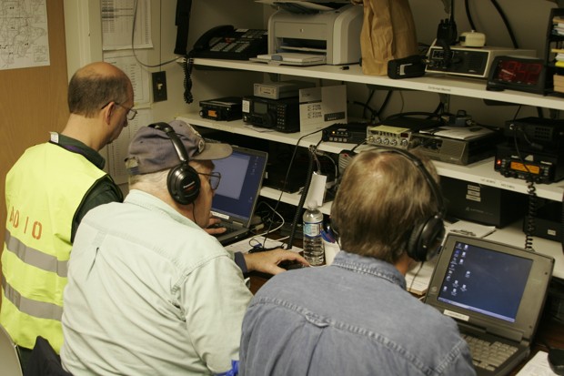
Ham radio operators in the emergency operations center radio room. (Courtesy of Rick Wallace)

Click here to read the entire story at CityLab.

Great ShakeOut Earthquake Drill – Oct. 18, 2018

Many areas of the globe are prone to earthquakes. You could be anywhere when an earthquake strikes: at home, at work, at school or even on vacation. Are you prepared to survive and to recover quickly? October 18, 2018 is the date to practice.

Great ShakeOut earthquake drills are an opportunity to practice how to be safer during earthquakes: “Drop, Cover and Hold On.” ShakeOut also has been organized to encourage you, your community, your school, or your organization to update emergency plans and supplies, and to secure your space in order to prevent damage and injuries.

Why is it important to do a Drop, Cover, and Hold On drill? To react quickly you must practice often. You may only have seconds to protect yourself in an earthquake, before strong shaking knocks you down–or drops something on you. Practicing helps you be ready to respond.

    • If you are inside a building, move no more than a few steps, then Drop, Cover and Hold On:
      • DROP to the ground (before the earthquake drops you!),
      • Take COVER by getting under a sturdy desk or table, and
      • HOLD ON to it until the shaking stops.

      Stay indoors till the shaking stops and you are sure it is safe to exit. In most buildings you are safer if you stay where you are until the shaking stops.

    • If you are outdoors when the shaking starts, you should find a clear spot away from buildings, trees, streetlights, and power lines, then Drop, Cover and Hold On. Stay there until the shaking stops.
  • If you are driving, pull over to a clear location, stop and stay there with your seatbelt fastened until the shaking stops. Once the shaking stops, proceed with caution and avoid bridges or ramps that might have been damaged.

Ground shaking during an earthquake is seldom the cause of injury. Most earthquake-related injuries and deaths are caused by collapsing walls and roofs, flying glass and falling objects. It is extremely important for a person to move as little as possible to reach the place of safety he or she has identified because most injuries occur when people try to move more than a short distance during the shaking.

Look around you now, before an earthquake. Identify safe places such as under a sturdy piece of furniture or against an interior wall in your home, office or school so that when the shaking starts you can respond quickly. An immediate response to move to the safe place can save lives. And that safe place should be within a few steps to avoid injury from flying debris.

Oregon: No Coastal Hospitals Likely to Be Functional After Large CSZ Quake

A new Oregon State Department of Geology report concludes that “no hospital facilities are likely to be functional due to the expected severity of a magnitude 9 Cascadia earthquake and tsunami damage. Seismic vulnerabilities include building structures; non-structural components that are part of the building as well as equipment; and the limitations of on-site utilities such as power and water. Four of the eleven hospitals are located in the tsunami evacuation zone and face difficulties with tsunami planning. ” The hospitals were constructed before CSZ earthquake expectations were known, and suffere from inadequate seismic resilience.  There are worries about fuel and water accessibility post-quake in addition to the possible damage from the earthquake and tsunami. The hospitals are expected to take over three years to recover from such a quake.

Download the DOGAMI report here (pdf)

Turning Anxiety to Action on the Cascadia Quake

From the Oregonian Editorial Board, Turning Anxiety to Action on the Cascadia Quake.

The New Yorker’s Pulitzer prize-winning piece on the massive destruction expected from a Cascadia Subduction Zone earthquake understandably struck fear in the hearts of many Oregonians who immediately set to work stocking emergency kits. At least some of them did. For a while.

Then came the terrifying video from Multnomah County, showing how the Burnside Bridge could rumble, torque and collapse after an 8-plus magnitude quake. The destruction alone is devastating to watch – even if by animated simulation. But it’s almost paralyzing to listen to the narration describing how bridge debris will block cars, emergency vehicles, trains and ships needed to bring supplies and evacuate victims.

It’d be easy to shove another recent state report into that corner in your brain where the darkest worries hang out. But despite its jarring numbers, the Oregon Department of Geology and Mineral Industries’ assessment released last week hits a few bright notes…

No matter how far you go, at least start.

Read the entire article at Oregonlive.com by clicking here.

Related:

Shakeout! Oct. 19, 2017

Millions of people worldwide will practice how to
Drop, Cover, and Hold On at 10:19 a.m. on October 19* during Great ShakeOut Earthquake Drills!

Washingtonians can join them today by registering for the 2017 Great Washington ShakeOut. Participating is a great way for your family or organization to be prepared to survive and recover quickly from big earthquakes– wherever you live, work, or travel. Learn tips on how to get 2 Weeks Ready and craft your own emergency kits here. ShakeOut is also a major activity of America’s PrepareAthon!

Start here to be included in the 2017 Washington ShakeOut!

The Pacific Coast of Washington is at risk from tsunamis. These destructive waves can be caused by coastal or submarine landslides or volcanism, but they are most commonly caused by large submarine earthquakes.

Tsunamis are generated when these geologic events cause large, rapid movements in the sea floor that displace the water column above. That swift change creates a series of high-energy waves that radiate outward like pond ripples. Offshore tsunamis would strike the adjacent shorelines within minutes and also cross the ocean at speeds as great as 600 miles per hour to strike distant shores. In 1946, a tsunami was initiated by an earthquake in the Aleutian Islands of Alaska; in less than 5 hours, it reached Hawaii with waves as high as 55 feet and killed 173 people.

Tsunami waves can continue for hours. The first wave can be followed by others a few minutes or a few hours later, and the later waves are commonly larger. Washington Emergency Management Tsunami Program

The earthquake threat in Washington is not uniform. While most earthquakes occur in Western Washington, some damaging events, such as the 1872 magnitude 6.8 (est.) quake, do occur east of the Cascades. Geologic evidence documents prehistoric magnitude 8 to 9.5 earthquakes along the outer coast, and events of magnitude 7 or greater along shallow crustal faults in the urban areas of Puget Sound.

Washington’s earthquake hazards reflect its tectonic setting. The Pacific Northwest is at a convergent continental margin, the collision boundary between two tectonic plates of the earth’s crust. The Cascadia subduction zone, the fault boundary between the North America plate and the Juan de Fuca plate, lies offshore from northern California to southern British Columbia. The two plates are converging at a rate of about 2 inches per year. In addition, the northward-moving Pacific plate is pushing the Juan de Fuca plate north, causing complex seismic strain to accumulate. The abrupt release of this slowly accumulated strain causes earthquakes.
Earthquakes at Washington Military Department Emergency Management Division.

In Washington, earthquakes and landslides are the most likely sources of a tsunami.

The Pacific Rim countries have a history of damaging tsunamis caused by both distant and local earthquakes. Earthquakes have caused 98% of the world’s tsunamis with over 73% of these being observed along the Pacific “Ring of Fire”. For this reason, communities in low-lying coastal areas around the Pacific Rim are among the most at risk to tsunami damages generated from both local and distant sources that can strike within minutes to many hours.

Washington State Earthquake Scenario Catalog (Washington State Department of Natural Resources)

DNR Interactive Geology Portal (Washington State Department of Natural Resources)

The Seattle Fault – Beneath Largest City in the Pacific Northwest (2 minute Geology, from HUGEfloods.com Youtube Channel)

Tsunami inundation maps (Washington State Department of Natural Resources)

Tsunami Evacuation Zones (Washington State Department of Natural Resources)

Recent Earthquakes Map (Pacific Northwest Seismic Network)

Earthquakes in Washington (United States Geological Survey)